Kategorie:Karte
Zur Navigation springen
Zur Suche springen
Medien in der Kategorie „Karte“
Folgende 141 Dateien sind in dieser Kategorie, von 341 insgesamt.
(vorherige Seite) (nächste Seite) Regionalkarte Marakatam physisch-beschriftet.jpg 1.320 × 1.120; 778 KB
 Regionalkarte Marakatam physisch.jpg 1.320 × 1.120; 807 KB
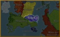
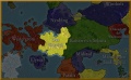
 Regionalkarte Marakatam politisch.jpg 480 × 327; 108 KB
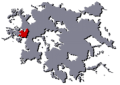
 Regionalkarte Marakatam Umriss-in-Lorakis.png 842 × 596; 303 KB
 Regionalkarte Mertalischer Städtebund physisch-beschriftet.jpg 1.320 × 720; 525 KB
 Regionalkarte Mertalischer Städtebund physisch.jpg 1.320 × 720; 525 KB
 Regionalkarte Mertalischer Städtebund politisch.jpg 523 × 367; 139 KB
 Regionalkarte Mertalischer Städtebund Umriss-in-Lorakis.png 842 × 596; 300 KB
 Regionalkarte Midstad physisch-beschriftet.jpg 1.320 × 720; 547 KB
 Regionalkarte Midstad physisch.jpg 1.320 × 720; 588 KB
 Regionalkarte Midstad politisch.jpg 588 × 364; 169 KB
 Regionalkarte Midstad Umriss-in-Lorakis.png 842 × 596; 302 KB
 Regionalkarte Nagasümpfe physisch-beschriftet.jpg 1.320 × 720; 514 KB
 Regionalkarte Nagasümpfe physisch.jpg 1.320 × 720; 566 KB
 Regionalkarte Nagasümpfe politisch.jpg 410 × 327; 96 KB
 Regionalkarte Nagasümpfe Umriss-in-Lorakis.png 842 × 596; 303 KB
 Regionalkarte Nalugasar physisch-beschriftet.jpg 1.320 × 720; 499 KB
 Regionalkarte Nalugasar physisch.jpg 1.320 × 720; 552 KB
 Regionalkarte Nalugasar politisch.jpg 581 × 378; 117 KB
 Regionalkarte Nalugasar Umriss-in-Lorakis.png 842 × 596; 300 KB
 Regionalkarte Nyrdfing physisch-beschriftet.jpg 1.320 × 720; 576 KB
 Regionalkarte Nyrdfing physisch.jpg 1.320 × 720; 588 KB
 Regionalkarte Nyrdfing politisch.jpg 588 × 364; 166 KB
 Regionalkarte Nyrdfing Umriss-in-Lorakis.png 842 × 596; 302 KB
 Regionalkarte Pangawai physisch-beschriftet.jpg 1.320 × 920; 635 KB
 Regionalkarte Pangawai physisch.jpg 1.320 × 920; 718 KB
 Regionalkarte Pangawai politisch.jpg 359 × 300; 69 KB
 Regionalkarte Pangawai Umriss-in-Lorakis.png 842 × 596; 303 KB
 Regionalkarte Pash Anar politisch.jpg 626 × 551; 295 KB
 Regionalkarte Pash Anar Umriss-in-Lorakis.png 842 × 596; 312 KB
 Regionalkarte Pash-Anar physisch-beschriftet.jpg 2.502 × 2.204; 2,85 MB
 Regionalkarte Pash-Anar physisch.jpg 2.502 × 2.204; 3,18 MB
 Regionalkarte Pashtar physisch-beschriftet.jpg 1.320 × 920; 670 KB
 Regionalkarte Pashtar physisch.jpg 1.320 × 920; 695 KB
 Regionalkarte Pashtar politisch.jpg 522 × 426; 161 KB
 Regionalkarte Pashtar Umriss-in-Lorakis.png 842 × 596; 302 KB
 Regionalkarte Patalis physisch-beschriftet.jpg 1.320 × 850; 627 KB
 Regionalkarte Patalis physisch.jpg 1.320 × 850; 653 KB
 Regionalkarte Patalis politisch.jpg 588 × 364; 163 KB
 Regionalkarte Patalis Umriss-in-Lorakis.png 842 × 596; 303 KB
 Regionalkarte Riesheim physisch-beschriftet.jpg 720 × 920; 483 KB
 Regionalkarte Riesheim physisch.jpg 720 × 920; 438 KB
 Regionalkarte Rotfurt physisch-beschriftet.jpg 1.019 × 769; 386 KB
 Regionalkarte Sadu physisch-beschriftet.jpg 1.644 × 1.140; 927 KB
 Regionalkarte Sadu physisch.jpg 1.644 × 1.140; 1.000 KB
 Regionalkarte Sadu politisch.jpg 639 × 431; 168 KB
 Regionalkarte Sadu Umriss-in-Lorakis.png 842 × 596; 301 KB
 Regionalkarte Schattenwald physisch-beschriftet.jpg 1.320 × 720; 509 KB
 Regionalkarte Schattenwald physisch.jpg 1.320 × 720; 552 KB
 Regionalkarte Schattenwald politisch.jpg 479 × 406; 131 KB
 Regionalkarte Schattenwald Umriss-in-Lorakis.png 842 × 596; 302 KB
 Regionalkarte Schattenwand physisch-beschriftet.jpg 1.320 × 920; 749 KB
 Regionalkarte Schattenwand physisch.jpg 1.320 × 920; 818 KB
 Regionalkarte Schattenwand politisch.jpg 532 × 398; 155 KB
 Regionalkarte Schattenwand Umriss-in-Lorakis.png 842 × 596; 304 KB
 Regionalkarte Schwarze Wälder physisch-beschriftet.jpg 1.320 × 720; 541 KB
 Regionalkarte Schwarze Wälder physisch.jpg 1.320 × 720; 589 KB
 Regionalkarte Schwarze Wälder politisch.jpg 588 × 364; 164 KB
 Regionalkarte Schwarze Wälder Umriss-in-Lorakis.png 842 × 596; 301 KB
 Regionalkarte Selenia physisch-beschriftet.jpg 1.320 × 1.026; 876 KB
 Regionalkarte Selenia physisch.jpg 1.320 × 1.026; 874 KB
 Regionalkarte Selenia politisch.jpg 1.072 × 788; 461 KB
 Regionalkarte Selenia Umriss-in-Lorakis.png 842 × 596; 306 KB
 Regionalkarte Shahandir physisch-beschriftet.jpg 1.320 × 920; 638 KB
 Regionalkarte Shahandir physisch.jpg 1.320 × 920; 680 KB
 Regionalkarte Shahandir politisch.jpg 590 × 410; 167 KB
 Regionalkarte Shahandir Umriss-in-Lorakis.png 842 × 596; 299 KB
 Regionalkarte Smaragdküste physisch-beschriftet.jpg 1.369 × 1.096; 950 KB
 Regionalkarte Smaragdküste physisch.jpg 1.369 × 1.096; 1,24 MB
 Regionalkarte Smaragdküste politisch.jpg 634 × 578; 286 KB
 Regionalkarte Smaragdküste-in-Lorakis geographischer-Umriss.png 842 × 596; 304 KB
 Regionalkarte Stromlandinseln physisch-beschriftet.jpg 1.882 × 1.018; 817 KB
 Regionalkarte Stromlandinseln physisch.jpg 1.882 × 1.018; 895 KB
 Regionalkarte Stromlandinseln politisch.jpg 663 × 322; 112 KB
 Regionalkarte Stromlandinseln Umriss-in-Lorakis.png 842 × 596; 300 KB
 Regionalkarte Suderinseln physisch-beschriftet.jpg 1.320 × 720; 452 KB
 Regionalkarte Suderinseln physisch.jpg 1.320 × 720; 500 KB
 Regionalkarte Suderinseln politisch.jpg 483 × 366; 100 KB
 Regionalkarte Suderinseln Umriss-in-Lorakis.png 842 × 596; 300 KB
 Regionalkarte Surmakar physisch-beschriftet.jpg 1.320 × 1.120; 864 KB
 Regionalkarte Surmakar physisch.jpg 1.320 × 1.120; 874 KB
 Regionalkarte Surmakar politisch.jpg 514 × 427; 156 KB
 Regionalkarte Surmakar Umriss-in-Lorakis.png 842 × 596; 306 KB
 Regionalkarte Takasadu physisch-beschriftet.jpg 1.486 × 928; 985 KB
 Regionalkarte Takasadu physisch.jpg 1.486 × 928; 1,18 MB
 Regionalkarte Takasadu politisch.jpg 730 × 494; 275 KB
 Regionalkarte Takasadu-in-Lorakis geographischer-Umriss.png 842 × 596; 304 KB
 Regionalkarte Tar-Kesh physisch-beschriftet.jpg 1.320 × 720; 530 KB
 Regionalkarte Tar-Kesh physisch.jpg 1.320 × 720; 560 KB
 Regionalkarte Tar-Kesh politisch.jpg 496 × 342; 127 KB
 Regionalkarte Tar-Kesh Umriss-in-Lorakis.png 842 × 596; 302 KB
 Regionalkarte Termark physisch-beschriftet.jpg 1.320 × 720; 529 KB
 Regionalkarte Termark physisch.jpg 1.320 × 720; 552 KB
 Regionalkarte Termark politisch.jpg 588 × 364; 144 KB
 Regionalkarte Termark Umriss-in-Lorakis.png 842 × 596; 302 KB
 Regionalkarte Tir Durghachan physisch-beschriftet.jpg 1.556 × 1.120; 920 KB
 Regionalkarte Tir Durghachan physisch.jpg 1.556 × 1.120; 944 KB
 Regionalkarte Tir Durghachan politisch.jpg 588 × 364; 136 KB
 Regionalkarte Tir Durghachan Umriss-in-Lorakis.png 842 × 596; 301 KB
 Regionalkarte Turubar physisch-beschriftet.jpg 1.320 × 720; 589 KB
 Regionalkarte Turubar physisch.jpg 1.320 × 720; 649 KB
 Regionalkarte Turubar politisch.jpg 383 × 335; 100 KB
 Regionalkarte Turubar Umriss-in-Lorakis.png 842 × 596; 305 KB
 Regionalkarte Unreich physisch-beschriftet.jpg 1.320 × 720; 610 KB
 Regionalkarte Unreich physisch.jpg 1.320 × 720; 649 KB
 Regionalkarte Unreich politisch.jpg 588 × 364; 173 KB
 Regionalkarte Unreich Umriss-in-Lorakis.png 842 × 596; 303 KB
 Regionalkarte Wandernde Wälder physisch-beschriftet.jpg 2.190 × 938; 327 KB
 Regionalkarte Wandernde Wälder physisch.jpg 2.190 × 938; 404 KB
 Regionalkarte Wandernde Wälder politisch.jpg 739 × 392; 201 KB
 Regionalkarte Wandernde Wälder Umriss-in-Lorakis.png 842 × 596; 308 KB
 Regionalkarte Westergrom physisch-beschriftet.jpg 1.320 × 1.040; 756 KB
 Regionalkarte Westergrom physisch.jpg 1.320 × 1.040; 799 KB
 Regionalkarte Westergrom politisch.jpg 588 × 364; 161 KB
 Regionalkarte Westergrom Umriss-in-Lorakis.png 842 × 596; 301 KB
 Regionalkarte Wintholt physisch-beschriftet.jpg 1.320 × 1.520; 1,17 MB
 Regionalkarte Wintholt physisch.jpg 1.320 × 1.520; 1,21 MB
 Regionalkarte Wintholt politisch.jpg 420 × 485; 149 KB
 Regionalkarte Wintholt Umriss-in-Lorakis.png 842 × 596; 308 KB
 Regionalkarte Wächterbund physisch-beschriftet.jpg 1.320 × 720; 552 KB
 Regionalkarte Wächterbund physisch.jpg 1.320 × 720; 575 KB
 Regionalkarte Wächterbund politisch.jpg 470 × 353; 113 KB
 Regionalkarte Wächterbund Umriss-in-Lorakis.png 842 × 596; 302 KB
 Regionalkarte Zaruszai physisch-beschriftet.jpg 376 × 364; 117 KB
 Regionalkarte Zhoujiang physisch-beschriftet.jpg 2.012 × 1.146; 1,26 MB
 Regionalkarte Zhoujiang physisch.jpg 2.012 × 1.146; 1,33 MB
 Regionalkarte Zhoujiang politisch.jpg 599 × 390; 159 KB
 Regionalkarte Zhoujiang Umriss-in-Lorakis.png 842 × 596; 308 KB
 Regionalkarte Zwingard physisch-beschriftet.jpg 1.320 × 850; 640 KB
 Regionalkarte Zwingard physisch.jpg 1.320 × 850; 672 KB
 Regionalkarte Zwingard politisch.jpg 588 × 364; 162 KB
 Regionalkarte Zwingard Umriss-in-Lorakis.png 842 × 596; 303 KB
 Stadtplan Ioria beschriftet.jpg 3.000 × 2.122; 5,99 MB
 Stadtplan Ioria.jpg 3.368 × 2.382; 3,88 MB
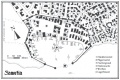 Stadtplan Samutia.jpg 687 × 459; 85 KB
 Unter-der-Lupe Dämmerwald.jpg 1.000 × 707; 669 KB
 Unter-der-Lupe Farukan.jpg 1.000 × 707; 372 KB
 Unter-der-Lupe Mahaluu.jpg 1.000 × 707; 317 KB
 Unter-der-Lupe Mertalia.jpg 1.000 × 707; 127 KB
 Unter-der-Lupe Wintholt.jpg 1.000 × 707; 140 KB
 Zuflucht Small.jpg 1.907 × 1.104; 2,04 MB


